Tag Archives: walks

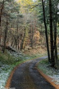
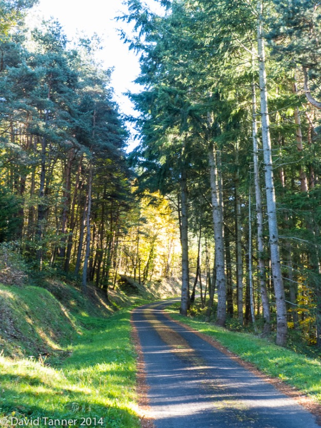
Trees along the Montclard road


P1000524

“…begin with the near and familiar. It is in learning to love and cherish our own little tree, or field or brook that we become fitted for wider and deeper affections”
R. S. Thomas preface to The Batsford Book of Country Verse.

We live on a tiny road, that winds up through the forest from the village below to our hamlet and then on to the next village about 5k up the road. Between our house and the next village the forest varies between conifers, firs and deciduous mixed woodland, mainly beech, oak and ash. We have walked this route for over five years now, in all weathers and all seasons, building up a large library of photographs. During our walks we have seen wild boar, foxes, pine martens, stoats, feral cats, ravens and numerous buzzards and failed to photograph any of them! It’s an ever changing scene through the seasons, with autumn possibly the star as the forest really glows at that time of year.


Morning walk

early morning sun and trees

early morning sun on the road to La Pelouche

Partly due to wanting to lose some weight and to keep my fitness up over the summer, I’ve started walking around 2 miles every morning after breakfast. Always after breakfast, I’ve tried walking before and my blood sugar must be really low as I never feel very good.

This summer has been so hot that long walks and cycle rides have been out of the question and a lot of lounging around watching the Tour de France has occurred. So the walks are to compensate for this and I’ll probably continue even when it gets a bit cooler in the autumn.

I usually walk up the road from our house to the next hamlet, then down a track leading to a woodland chapel, but turning round after a mile is recorded on my iPhone walking app. The wildlife about early morning varies, though this morning was particularly good for wildlife spotting. I saw two buzzards (Buse Variable), a green woodpecker (Pic Vert) heard a black woodpecker (Pic Noir) and saw a fox heading across a field. Not bad for a 40 minute walk! This morning was bright, sunny and 15C, though we a due a high of 33C. If you look carefully at the last photo you can see the parched yellow fields due to this July canicule (heat-wave, literally “dog days”).

view over the doulon valley

view over the Doulon valley towards Domeyrat

20150724 090452

looking towards the Mageride from the hamlet of La Pelouche

weekly photo challenge: orange

The challenge this week was “orange” and I took the opportunity of a countryside walk to pick out suitable subjects. What soon becomes clear are the many shades of orange trending from the edges of yellow and blending into red. I had hoped that the local brickwork and tiles would offer some good shots and I was not disappointed , but orange can be found in many places, even sitting on a bridge!


Walk: Domeyrat – Lavaudieu

20150219-155547

lavaudieu

This is a walk we have done parts of before and looking at the map we could see we could link a couple of these paths and make a round trip between the two villages both situated on the Senouire river. It was a perfect day for a walk, sunny, a light breeze and 15c.

The views over to the snow covered Puy de Sancy was spectacular.
20150219-143025

lugeac and the puys

A feature were the various spring flowers, snowdrops, celandines and hellebores.

More pictures from the walk.


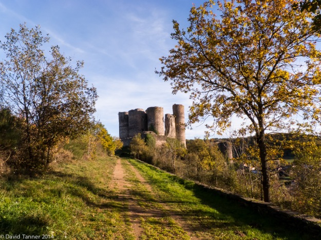
A walk around Domeyrat Castle

20141113-154142


Sometimes the best walks are the unexpected ones. We had set out to do a favourite walk from Domeyrat village along the railway line and back through the woods along the river. However the local chasse (hunt) were spread along our proposed route and we never feel particularly safe if walking paths in the middle of the chasse.

So we decided on combining a couple of routes we had covered on other longer walks to make a shorter circular route past and around the castle. It was a beautiful afternoon with the trees looking particularly fine in the late afternoon light.


weekly photo challenge: descent

20090315-114000

Heading down into Horton in Ribblesdale from Pen Y Ghent

This weeks topic gave me an opportunity to look through the many photos I have of walks in the Lake District and the Yorkshire Dales. I’ve been using Lightroom for over a year now and these were all still in iPhoto, which now seems a complete pain to use! I also always shoot RAW files nowadays and these were all jpegs, mostly from a small Canon Powershot, so I’m quite pleased with how they have turned out with a little tweaking in Lightroom.

20100411-084440

Descending Pen Y Ghent

20110514-130800

Leaving Great Gable and heading towards Styhead

20110516-070329

The restored path from Sty Head to Seathwaite

20070512-151519

Descending from Helvellyn via Swirral Edge, with Catsycam in the distance


walk PR 15 (Lavoûte-Chilhac) – Le Tour du Pié du Roi (9.5km)

A (mostly) lovely walk in glorious late autumn weather.

20141031-124432

Making the most of the continuing warm sunny weather, we headed out to the village of Cerzat yesterday, for a walk which promised a volcanic crater, basalt cliffs and spectacular views over the Allier valley.

It all started well. We found our way out of the village, and across open farmland to the Pié du Roi, which is the crater of a long extinct volcano. It was a glorious day, with mellow autumn light and long shadows.

It was soon after this that we started to have “challenges” with our route finding.

Walking in France on official routes is usually pretty easy. They tend to follow clearly defined paths and tracks, rather than cutting across open ground as they often do in the UK. In addition, there is a clear system of way marks, and wherever there is a choice of paths, the correct one will be marked with a dash, and…

View original post 289 more words

Auvergne: clouds and sky

20141014-151158

On a recent walk from Vals le Chastel up and over to the hamlet of Le Pin (The Pine), the sky and clouds were putting on a spectacular display. The photographs were taken at about 600 metres of altitude, looking towards the Margaride and Cevennes hills in the far distance. The yellow and red stripes on the tree in the photo above are the french footpath way marks letting you know you are on the correct route!

20141014-152659


20141014-151230

First autumn colours

One of the advantages of living in a forest is that small roads and tracks go off all around us, providing endless opportunities for walking straight from the house.

One of our favourites follows the forest road up from our house towards the Col de Montclard.

20131112-144620


A couple of hundred metres up the road and you reach a break in the trees with a glorious view over the Senouire valley and towards the Margaride and Cézallier mountains.

20131112-145151

We either go all the way up to the Col, or turn round at the curés house. This is an old farmhouse owned by a retired priest, who only visits occasionally. ( More photos over on La Petite Maison)

20141013-152658

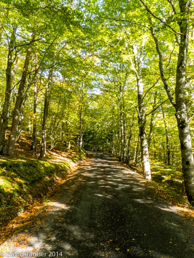
Half way along, the road goes through a lovely beech grove which is just beginning to show its autumn colour. Soon the leaves will have all changed to a deep golden brown and then fall to join last years leaves still on the ground. Autumn is one of my favourite times of the year and here in the Auvergne it blazes into colour.

20141013-151346


20141013-151305

20141013-151218

Walk PR 30 (Brioude) – Des Mines à la Fontaine Saint-Eutrope (11km)

20140815-125838

This is a walk we have done once before and is a fairly flat circular route visiting the villages of Fontannes – Frugerolles – Billanges – Buze – Fontannes. The highlight of the walk was the profusion of wild flowers on the verges.

We also had a brief encounter with an inquisitive lizard!

20140815-114938

The route gives you distant views of both Brioude and the Puys.

This slideshow requires JavaScript.

Other interesting features were this old cross outside Billanges, and the Maison Rouge at Buze.

A lovely walk in warm though not hot conditions, on good paths throughout.

20140815-112617